Rapha Compass Challenge: Big Ride Energy
In keeping with the theme of COVID summer socially distanced cycling challenges, Rapha created the Rapha Compass Challenge. The challenge was simply to navigate and ride to 4 designated coordinates in your Rapha Cycle Clubhouse region within the challenge period. Anyone who captured all 4 on a single ride was eligible to win additional prizes (and Strava kudos). Challenge accepted!

Rapha Cycle Club NYC’s Coordinate List
“Inspired by the continent-crossing rides of early 20th century cyclists, the Rapha Compass Challenge is a ride with a difference. This August, we’re inviting you to plot your own course between four coordinates surrounding one of our eight US Clubhouses – all in the space of a week.”
Step 1: Figure out whERE the heck the coordinates WEre
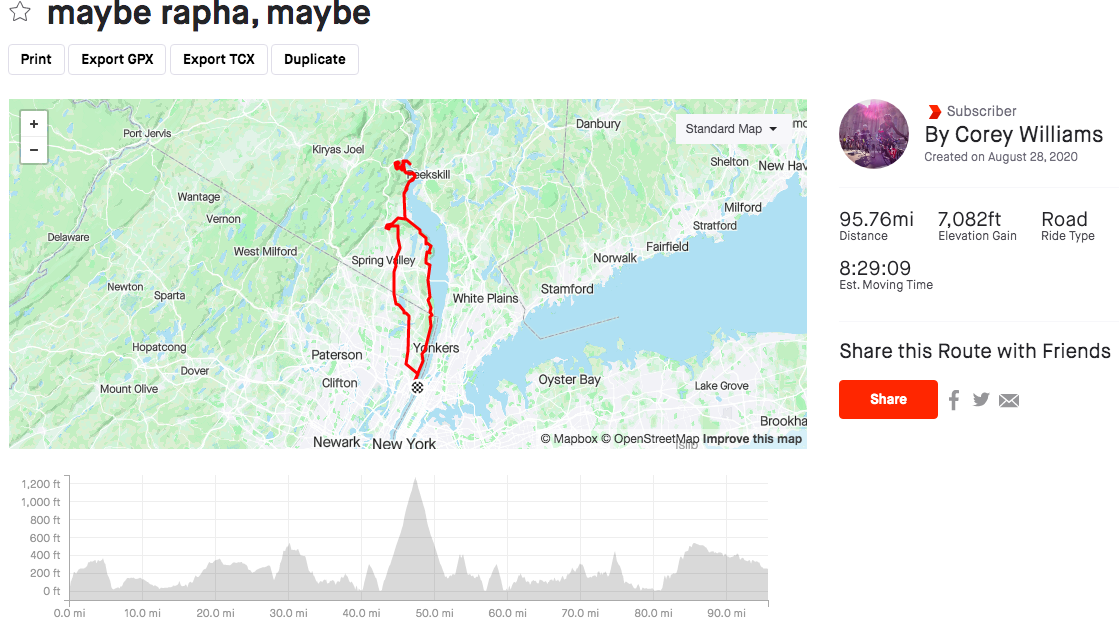
I consulted my pal, Google, and learned that the 4 NYC checkpoints were: a building in Rockland Lake State Park, the vista on Anthony’s Nose, the top of Perkins Drive on Bear Mountain, and the Orchards of Concklin. All the checkpoints were clustered a good ways north of NYC, with Rockland Lake, Orchards and Bear Mountain located west of the Hudson River, and Anthony’s Nose on the east side. From the George Washington Bridge, a typical ride to Rockland Lake (the closest of the checkpoints) would be about 50 miles round trip, so I knew this ride would enter century territory.

Step 2: Build my Route
Given I had all day on a Sunday for this exercise, and the forecast was calling for ideal temperatures (65-75 deg F), my priorities were as follows, in no particular order:
Complete round trip ride (no train transfer)
Minimize backtracking
Add fast dirt sections
Minimize time on 9W (a road NYC folks ride a bazillion times)
Minimize gratuitous climbing
Maximize scenic roads with fewer cars
Trend downhill for the back half of the ride to ensure I survive the day
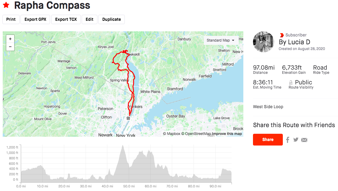
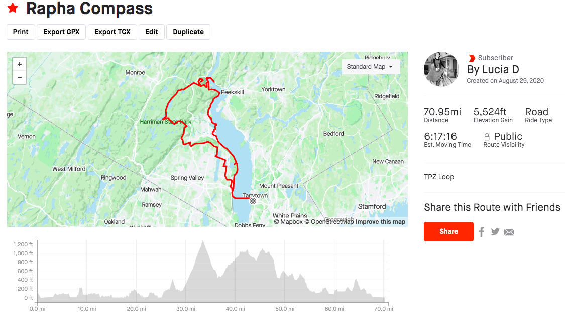
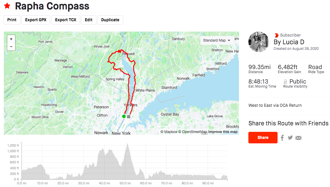
With this criteria in mind, I settled on the Scenic West Side Loop. But, here were the contenders:
Step 3:Ride the Thing
I made plans with Corey to start at 7:30AM, which was amended to 7:40AM the morning of. Being accountable to a friend is a great way to get out the door on time (or thereabouts).
Did I mention the weather was ideal?! Mid 60s to start and a tailwind. GLORIOUS. Lots of folks were out on bikes! I got a generous tow from Corey out to Tallman before we parted ways.
By the time I reached north of Nyack, other road users had thinned out. I took a slight detour at the entrance of Nyack Beach to see if I could find a shortcut to Rockland Lake, but no dice. The climb at the north end of the Nyack Beach Trail up to Rockland Lake is short, but a real leg buster. There was a trio of hikers who broke out into laughter and dance while taking a break halfway up the climb, and their energy was infectious. It put a smile on my face and gave me a boost to the top. The first checkpoint was a little building on the Rockland Lake loop called the Venture Academy. 1 down; 3 checkpoints and 75 miles left to go - EEP!


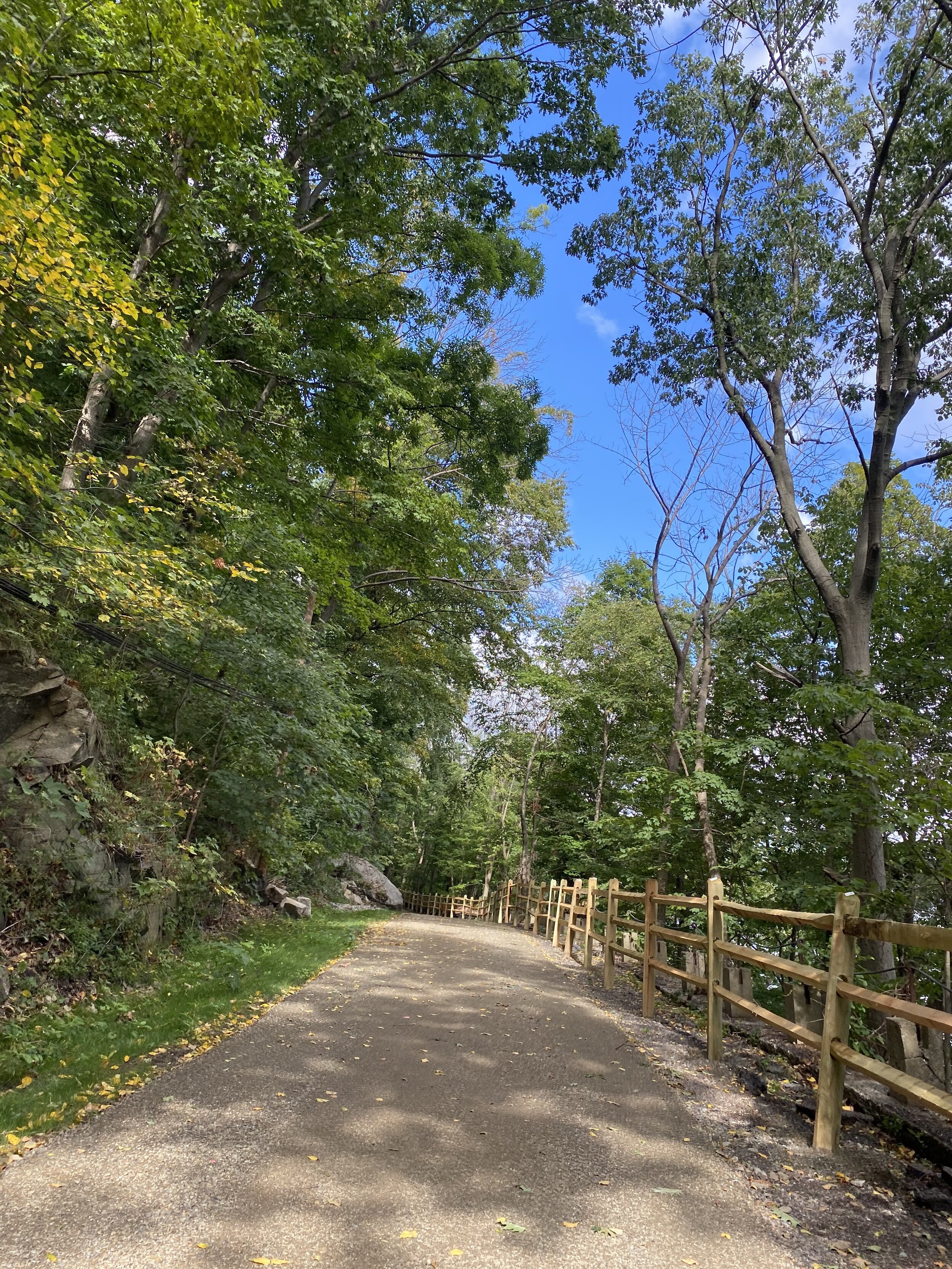
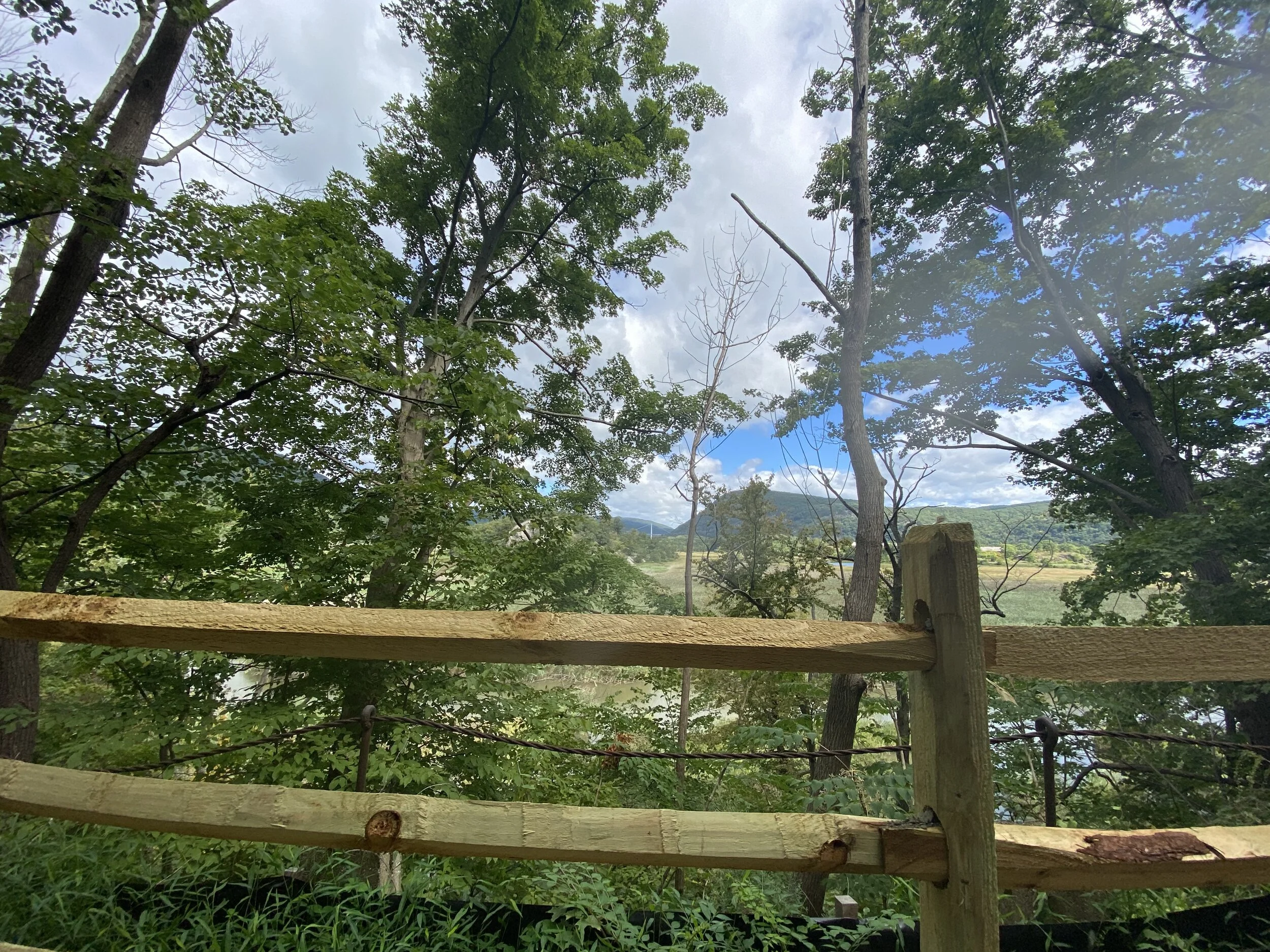
The segment to the second checkpoint, Anthony’s Nose, is one of my favorites because it includes the Haverstraw Trail, a scenic tour of Haverstraw Bay, and the Jones Point Path. It also avoids most of the narrow and chewed up 9W shoulder, and the major climbs to Bear Mountain State Park. The Haverstraw Trail is an undulating 3.5 mile path along the Hudson that is a mix of hard pack and “aged pavement.” It’s nicely shaded and is littered with leaves, twigs, and small errant rocks, so it requires 100% attention and some finessing. Still, totally rideable on 25mm slick tires. Haverstraw Bay is a nice flat section that meanders along the water, which is dotted with marinas. Finally, the Jones Point Path (which is still technically closed for construction), has been transformed from a narrow and rugged bush-whacky trail, into a wide and smooth hard pack gravel path with great views of the Bear Mountain Bridge and Anthony’s Nose. Part of me misses the old gnarly technical bits, but this new Path will be much more accessible for folks.
The Jones Point Path spits you out just before the southern 9W entrance to Bear Mountain State Park. Then, a bit of climbing up to the Bear Mountain Bridge, and then a bit more climbing up to Anthony’s Nose. Checkpoint 2 complete. Typically, the road up to Anthony’s Nose has a lot of car traffic. Today was no exception. But, by some miracle, when I turned around to descend, there were no cars following, so I was able to let it rip!

I’ll skip talking about the climb up to Bear Mountain (gah - I hate that climb - feels never ending). Though I will say, I was glad Perkins Drive was closed to cars and motorcycles. Checking off Bear gave me a great mental boost. It meant I was half way through the ride mileage-wise, and heading back towards home. Checkpoint 3 complete.
The next part of the route is a long stretch on Seven Lakes Drive (which includes a very short and not technically legal bit along the Palisades Interstate Parkway - caution!). The whole way through Harriman State Park is one of the most scenic of the ride: mostly shaded, tall pines, curvy undulating quiet roads, and glimmering lakes - heaven. I note that there’s a decent amount of cumulative climbing in this section, though it’s spread out, and well worth it for the views. Finally, this section ends with a screaming fast descent down Willow Grove Rd.
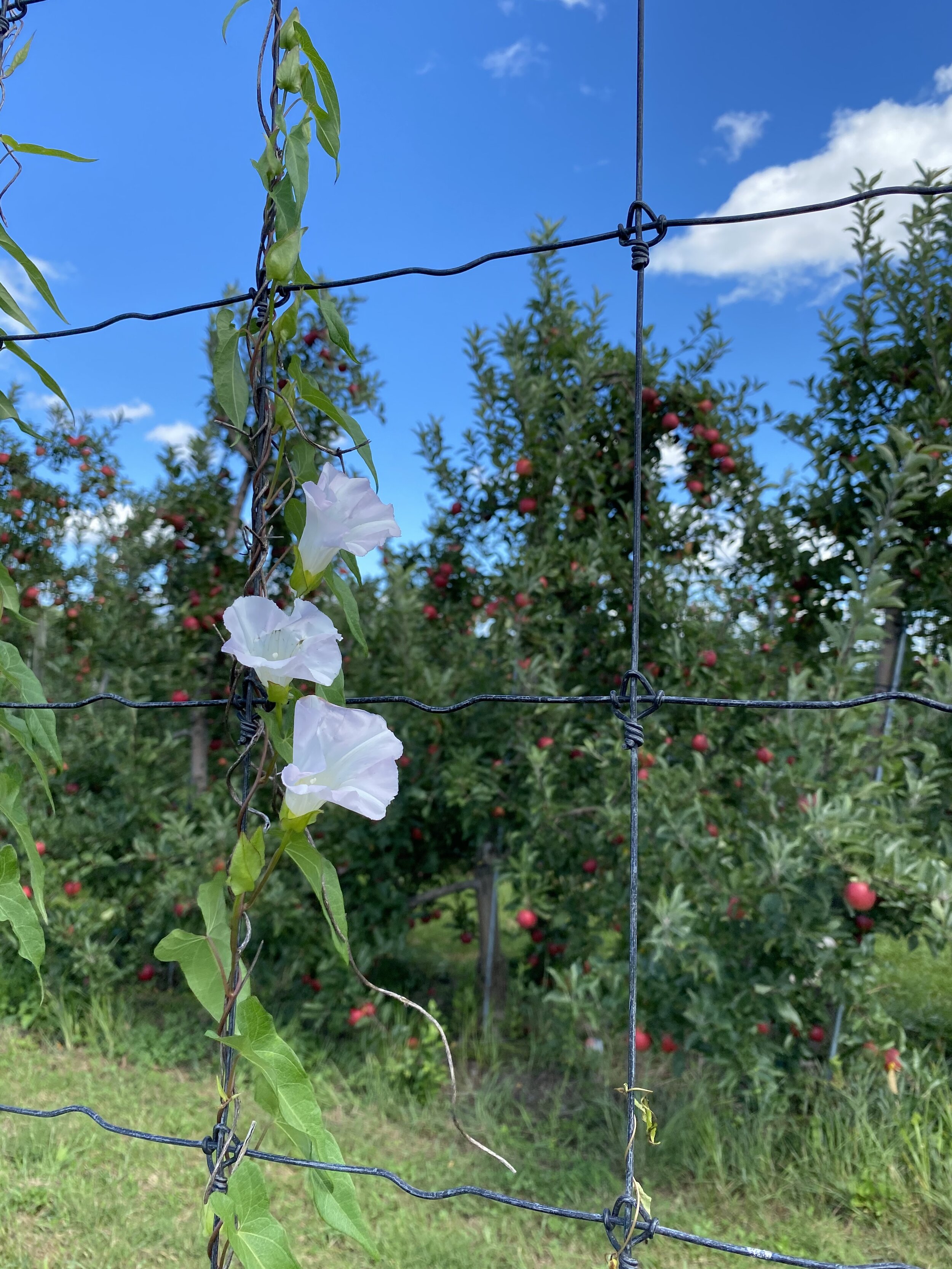
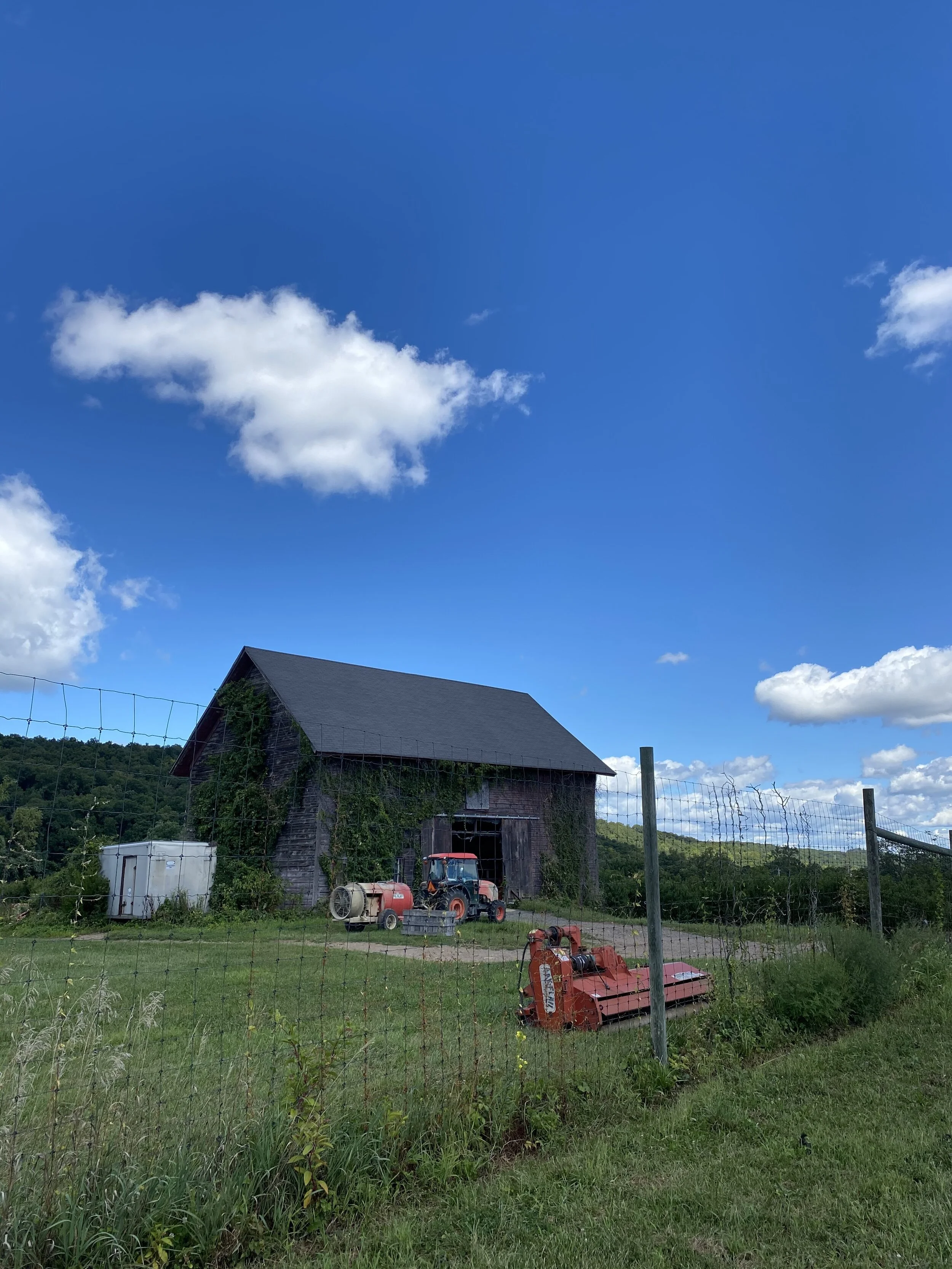
The 4th and final checkpoint, at mile 70, is Orchards of Concklin. This was a huge mental goalpost because I knew there’d be great snacks and cider, and the route trends downhill after. Descending South Mountain Road is a lot of fun - twisty and fast. Then, once you turn onto Ridge Road, it feels like a straight shot of tempo riding on smooth flat-ish suburban residential roads all the way back to Piermont. I was feeling surprisingly good at this point. I must have gotten my fueling right, or maybe I had a bit of a tailwind? Either way, I’ll take it!


When plotting the route, I decided to skip the 9W return, instead opting for Rt 340 to give myself a mostly flat and shaded ride back to the Palisades. I figured I might be running pretty ragged at this point. I definitely appreciated this decision. At mile 93, my legs started to cramp. I took more frequent swishes of tart apple cider from my bottle and shook out my legs from time to time. Thankfully, I managed to crawl up the last climb (Churchill) without my legs seizing, but just barely. There was an older gentleman jogging up Churchill, and I was hardly riding faster than him.
Once I got back across the GWB, I got a second wind, and breezed home on that BIG RIDE ENERGY. 105 miles, with just over 7000 feet of climbing, and in just over 7 hours riding time. Rapha Compass Challenge completed.
Here’s a link to the route if you want to give it a go: https://www.strava.com/routes/2734578269363727196