Trail Running in Saint John
Every once in a while a vacation mandates leaving the bike at home and bringing running shoes instead. As a recovering triathlete it's not a choice I make lightly but when the destination is Saint John and an island full of Caribbean trails it's really not so bad.
A quick summary of my favorite trails in Saint John follows below but for a much more thorough guide visit the Trail Bandit for the most comprehensive listing of official and unofficial trails available anywhere (more helpful than the National Park Service in my opinion).
Unfortunately after various disputes with the NPS and locals over trail access and maintenance (the trails were in noticeably worse condition this year) the Trail Bandit has shifted focus elsewhere but thankfully his work on Saint John is still available in app form.
Now onto the trails, many of which originate in Cruz Bay....
Lind Point TRAIL
By far the easiest to access and most trafficked trail in Saint John the Lind Point trail stretched just over a mile from Cruz Bay, past Solomon Beach to Honeymoon Beach and Caneel Bay with an option to detour via the Upper Lind Point Trail for nice views of Cruz Bay.
The trail is mostly flat and non-technical nature making it both a popular option for beach access to Solomon and Honeymoon and one of the few trails on the island where it's easy to inject some pace into a run.
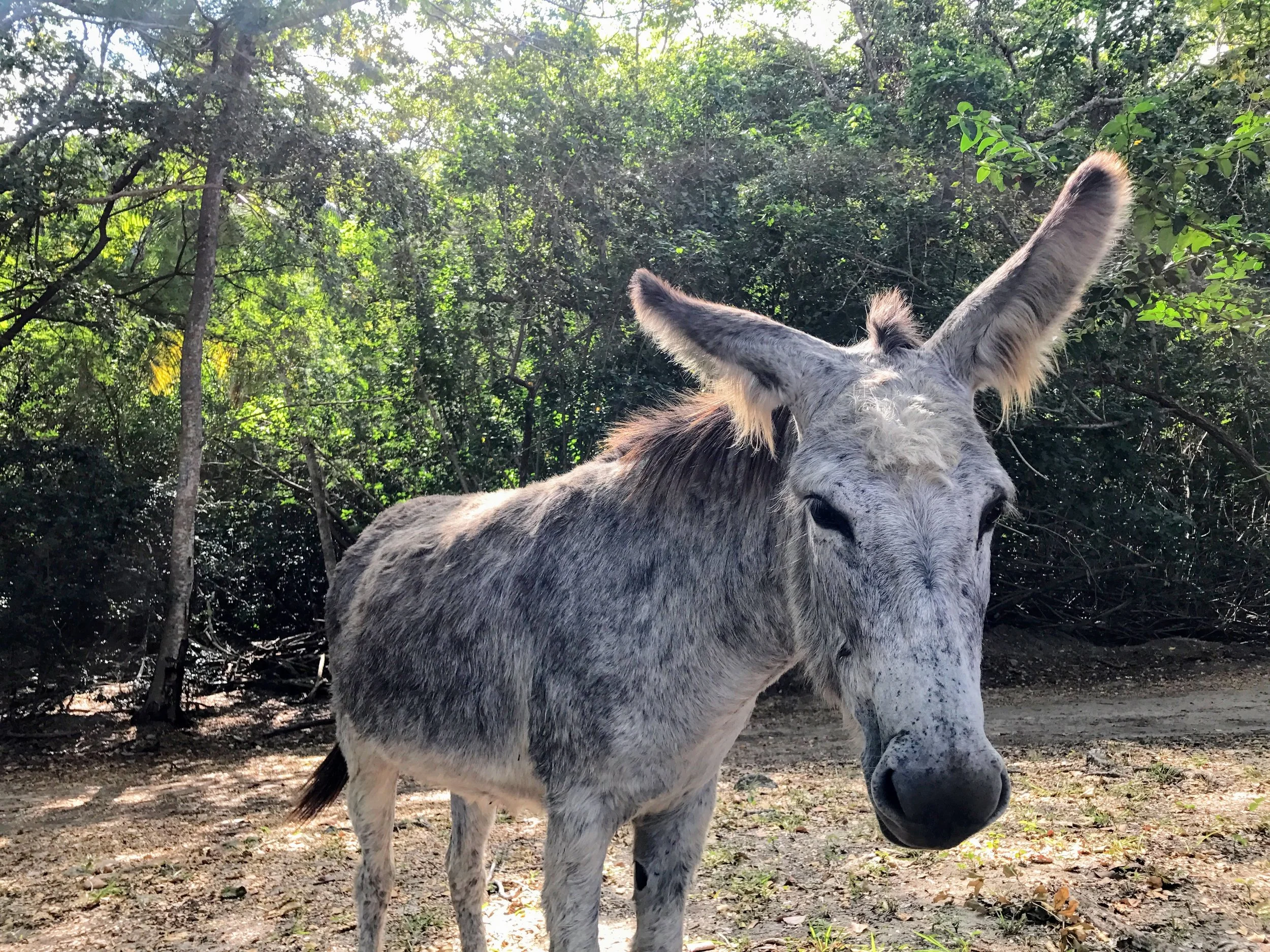
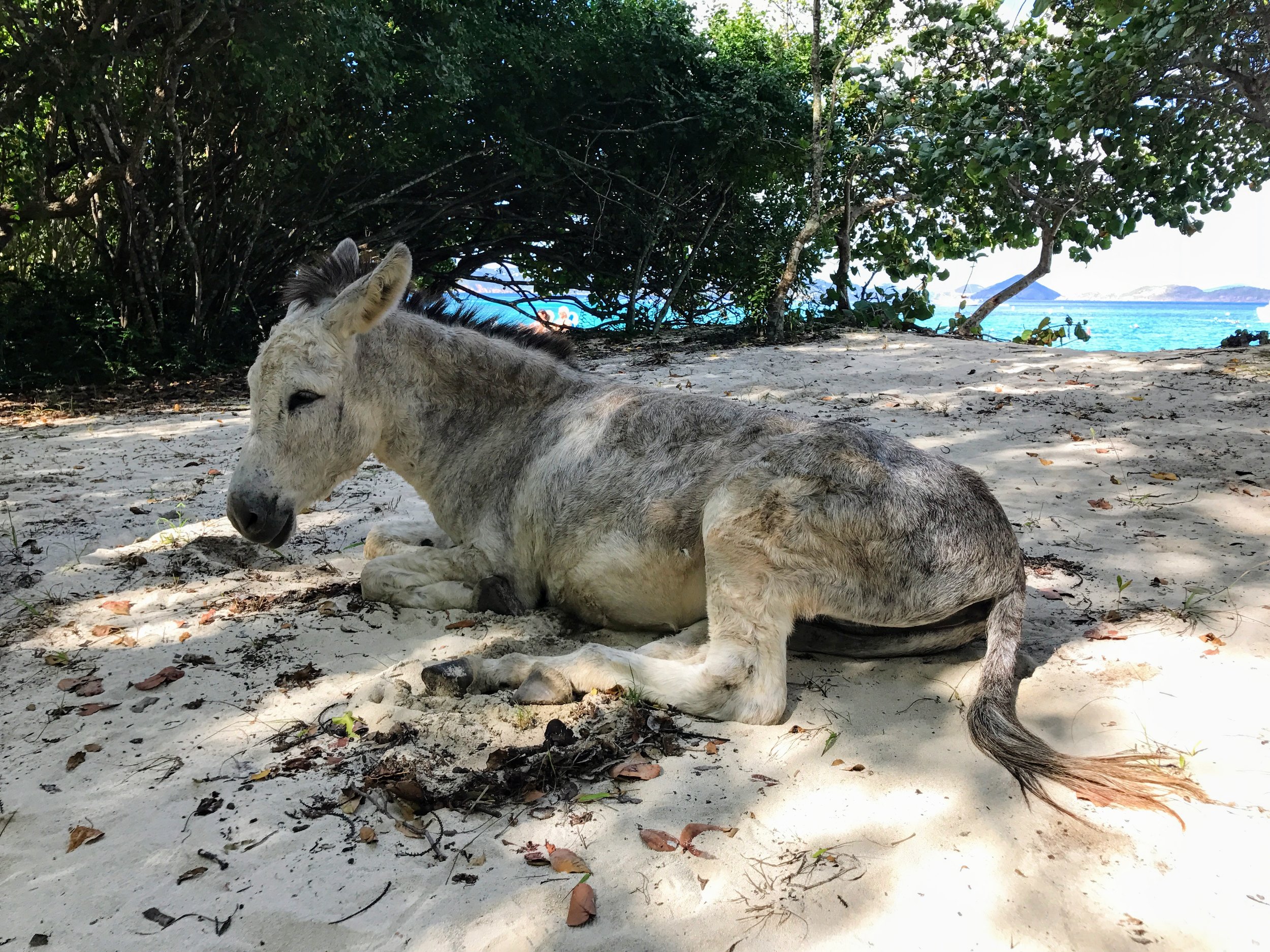
And if you're lucky you'll catch some of the donkeys hanging out at either end of the trail - in this instance they were lounging in the sand at Honeymoon beach when I hit the midway point.

LIND POINT - CANEEL HILL TRAIL
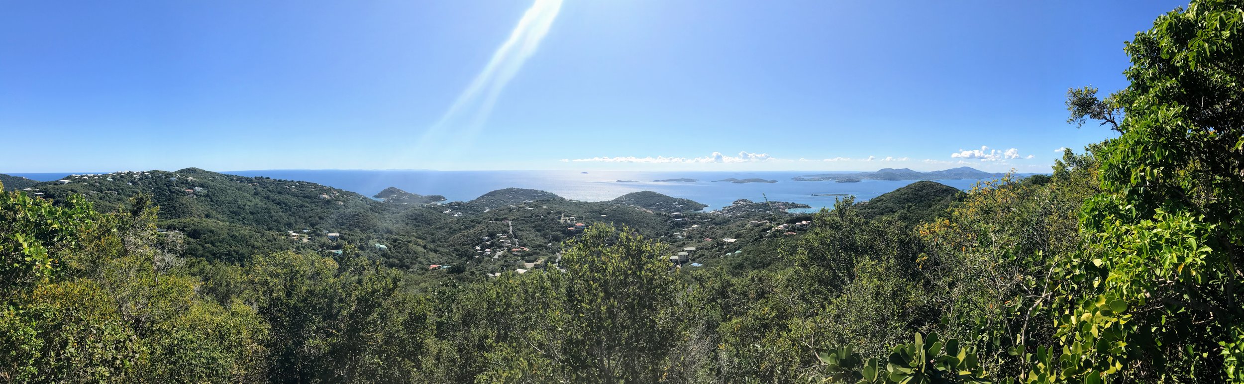
From Lind Point it's an easy connection to the Caneel Hill Trail that runs from the entrance of the Caneel Bay Resort over Margaret Hill, the highest summit on the West End of Saint John, and then over Caneel Hill before descending into downtown Cruz Bay.
The views from both Margaret Hill and Caneel Hill are impressive and worth the effort but be forewarned that it's a steep ascent out of Caneel Bay and at times the Resort can be prickly about hikers/joggers passing through.
With the elevation change and a few technical sections - including some overdue maintenance - this isn't a particularly fast loop, but again those views are well worth it. The summit of Caneel is cleared and features a lookout tower but for Margaret keep an eye out for some large boulders on your left while heading toward Cruz Bay -- climb those for the views.

For a bit of variety on this route take the Water Catchment Spur Trail part way up the ascent out of Caneel Bay Resort. It is an impressive bit of infrastructure though the ascent past the catchment is more of a creek bed than a trail for a short stretch, before ending at Centerline Road with an option to connect to the trail to Margaret Hill and ultimately back into Cruz Bay view either Caneel Hill or Lind Point.

LIND POINT - DENIS BAY TRAIL
Lind Point once again serves an an excellent launching point, this time for a quick run out to Denis Bay, one of the smaller beaches on the north side of Saint John.
Ideally this route would have connected from Lind Point to Hawksnest Beach via the Hawksnest Bay Trail, but the latter runs within the Caneel Bay Resort and security turned me away so I resorted to a much less pleasant stretch on the North Shore Road - complete with some hefty elevation changes. Not ideal.
From Hawksnest it's another ascent up Peace Hill, home to an old windmill tower and some impressive views back toward the bay. For the home stretch it is a short and mostly non-technical descent down to the white sand and blue water of Denis Bay.


SALT POND BAY - RAM HEAD - DRUNK BAY
One of the best hikes in Saint John traverses the dry and hot southeast tip of the island to impressive views on the cliffs of Ram Head Point. Starting at the busy parking lot atop Salt Bay Pond it's a short hike down a dirt road to the often times crowded sand beach below.
On the far end of the beach the 1-mile Ram Head Trail kicks off, covering a mix of terrain including some minor rock scrambling before traversing Blue Cobblestone Beach and beginning the ascent to the cliffs and associated views of Ram Head. In the midday sun it's a hot trek - bring some water - but well worth the effort.
On the way back hang a right at the Salt Pond for the 0.5-mile trail to Drunk Bay, also known as Dead Man's Bay due to the dozens of rock sculptures that line the beach.


L'Esperance Trail - Reef Bay Trail - Lameshur Bay Trail
In addition to Ram Head, the southern half of Saint John features a variety of trails descending from Centerline Road to the bays below. The majority of these trails intersect in or around Genti Bay, home to the Reef Bay Sugar Mill ruins that are some of the most impressive on the island.
Amongst the official NPS trails and a variety of old Danish Roads (see the Trail Bandit guide for additional details on the latter) the most popular option is likely the 2.1-mile Reef Bay Trail that features various minor ruins, the Taino Petroglyphs and mostly dry waterfalls in Living Gut, easy access to the very interesting Par Force Ruins and Reef Bay Great House before concluding at the sugar mill in Genti Bay.
With all of the spur trails it's easy to put together a 5+ mile out-and-back hike on the Reef Bay Trail but to mix things up this year I pieced together a longer one-way route that started with the L'Esperance Trail and continued partway up the Reef Bay Trail before cutting across the Lameshur Bay Trail.
The final stretch - along a mixture of dirt and paved roads - was a bit lackluster but overall is was a great way to get out to the beaches on the Southeast tip of Saint John. Definitely one of my favorite runs on this year's trip.


Cinnamon Bay - Caneel Hill
The first one hundred yards of the Cinnamon Bay trail feel like some of the steepest of any official NPS trail on Saint John but from there the terrain levels out slightly for a pleasant hike up to Centerline Road with a few scenic overlooks. If you are in the area of Cinnamon Bay it's worth exploring.
In this instance however I made the mistake of using this route to get back to Cruz Bay which necessitated a long run along Centerline Road. There are certainly worse places to run but I much rather would have maximized time on the trails (though there aren't many East/West options to choose from on the island) rather than dodging "rush hour" traffic headed back to the ferry dock at Cruz Bay.

Trail running saint john gallery
A few additional shots collected on various runs...